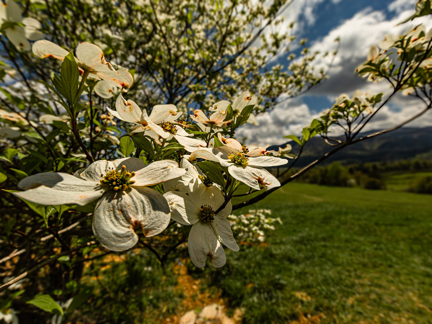
Tavern Branch Trail, Citico Creek Wilderness
Citico Road at Duncan Branch
Citico Road at Duncan Branch
Streamside Trail at Citico Creek Campsitee 9
Road to Nowhere, Tunnel Ridge Tunnel Entrance, July 11, 2023
Road to Nowhere, Tunnel Ridge Tunnel Exit, July 11, 2023
A place that had my imagination from early in researching this tirp was Hamilton. When I found the road, it was a good dirt route and remained so for a good while. Rounding a bend, I realized I was near the snow line on another mountain across the valley. After a few pictures from there, I moved on. Then, I rounded a bend to find a snow drift higher than the car across the road. Walking back to get a shot of the car and the drift, I noticed a rougher road that seemed as though it may by-pass the drift. I tried it, but soon came to a long muddy portion that I decided I should not try. Then, I saw a traveled trail back to the main road passed the big drift, but before a drift I probably could have navigated. I decided not to try it, because climbing back up to where I was may have been problematic. Later I realized there were probably more drifts before Hamilton. Later in the day I proved it.
Abrams Falls Trail
Turkey Creek Wetlands Walking Trail
Sunday afternoon, my wife wanted to see some fall color. We made it to Townsend, Tennessee for lunch at Timbers before the trip on Foothills Parkway to Chilhow2e Lake.
Sunday afternoon, my wife wanted to see some fall color. We made it to Townsend, Tennessee for lunch at Timbers before the trip on Foothills Parkway to Chilhow2e Lake.
Spirit of Nations Traditional PowwowOctoberr 17, 2009Krutch Park, Knoxville, TNwww.indiancreekproductions.com
Sunday Afternoon Walking Downtown Knoxville
Fathers Day Weekend, June 19 through 22, 2009
Fathers Day Weekend, June 19 through 22, 2009
Historic Concord fishing peers on a day when I looked for the original site of Concord United Methodist Church.
Mark Lewis, Caitlin Rockett and I intended to attend Earth Round Up at Maryville College. Along the way, we drove Highway 129 to see the bikes.
Chicago South Michigan Ave, near Chicago Art Institute, and Madison Ave.
Chicago South Michigan Ave, near Chicago Art Institute, and Madison Ave.
2009_03_04 AM ILAC & Licey
2009_03_04 AM ILAC & Licey
2009_03_04 AM ILAC & Licey
2009_03_04 AM ILAC & Licey
2009_03_03 All Day ILAC Clinic
2009_02_28 Near ILAC - East
2009_02_28 Near ILAC - East
2009_02_28 Near ILAC - East
2009_02_28 Near ILAC - East
2009_02_28 Near ILAC - East
2009_02_28 Near ILAC - East
2009_02_28 Near ILAC - East
2009_02_28 Near ILAC - East
2009_02_28 Near ILAC - East
2009_02_28 Near ILAC - East
2009_02_28 Near ILAC - East
2009_02_27 PM Santiago Center
2009_02_27 PM Santiago Center
2009_02_27 PM Santiago Center
2009_02_27 PM Santiago Center
2009_02_27 PM Santiago Center
2009_02_27 AM near ILAC
2009_02_27 AM near ILAC
2009_02_27 AM near ILAC
2009_02_27 AM near ILAC
2009_02_27 AM near ILAC
2009_02_27 AM near ILAC
2009_02_27 AM near ILAC
2009_02_27 AM near ILAC
Raven & Sophia came to Grammy's house for an early Christmas. Their dad arrived in Kuwait a couple of days ago.
Raven & Sophia came to Grammy's house for an early Christmas. Their dad arrived in Kuwait a couple of days ago.
Raven & Sophia came to Grammy's house for an early Christmas. Their dad arrived in Kuwait a couple of days ago.
Raven & Sophia came to Grammy's house for an early Christmas. Their dad arrived in Kuwait a couple of days ago.
For about three months, Coit has been spending a few weeks at a variety of army installations and returning to his home, wife and two of my granddaughters for a week or two at a time. Sophia was born during this time. He was home for too few days of Thanksgiving. On November 27, he and a lifelong friend left for the last time before traveling to the Middle East for a year. The friend’s family was there with us. I used Christie’s small point & shoot Canon to capture as much of the scene as I could.
After roaming through the lakes west of Grand Portage for an afternoon, we decided to leave our hotel in Grand Portage and follow a route through similar areas all day to spend a night at Two Harbors. Originally, we had thought we would go into Canada for that day. This meant that we would have only a short drive into Duluth for our last full day of the trip.
Delayed Fathers Day Weekend Trip 2010 - It is the 7th of these trips. This year our trip was delayed because Mark had significant job on a ESPN segment.
Delayed Fathers Day Weekend Trip 2010 - It is the 7th of these trips. This year our trip was delayed because Mark had significant job on a ESPN segment.
Delayed Fathers Day Weekend Trip 2010 - It is the 7th of these trips. This year our trip was delayed because Mark had significant job on a ESPN segment.
We go to Loudon for ice cream, at The Tic Toc, more often than is good for us. I am talking real sin here. The round trip is about 40 miles. I almost always look at the old water tower from various angles. A few days ago, I shot it with my LG eXpo cell phone. Today, I went back wiith my SLR specifically for the light and trees. While there, I took a few minutes to also shoot the realroad bridge, which crosses the Tennessee River.
We go to Loudon for ice cream, at The Tic Toc, more often than is good for us. I am talking real sin here. The round trip is about 40 miles. I almost always look at the old water tower from various angles. A few days ago, I shot it with my LG eXpo cell phone. Today, I went back wiith my SLR specifically for the light and trees. While there, I took a few minutes to also shoot the realroad bridge, which crosses the Tennessee River.
We go to Loudon for ice cream, at The Tic Toc, more often than is good for us. I am talking real sin here. The round trip is about 40 miles. I almost always look at the old water tower from various angles. A few days ago, I shot it with my LG eXpo cell phone. Today, I went back wiith my SLR specifically for the light and trees. While there, I took a few minutes to also shoot the realroad bridge, which crosses the Tennessee River.
While in Chicago for NAPFA National Conference 2010, I walked quit a bit in the park across the street from the Hilton Chicago. I found this shoe while walking to the train station for my flight home.
There is a great book I need to read someday. The title is “The Best Camera Is the One You Have with You.” We go to Loudon for ice cream, at The Tic Toc, more often than is good for us. I am talking real sin here. The round trip is about 40 miles. I almost always look at this water tower from various angles. I may have tried a few pictures with my SLR, but I don’t think so. Apparently I have ice cream on my mind too much. This time I didn’t have a camera with me except for my cell phone, which is a LG eXpo. As I bemoaned the lack of my “real camera,” I quoted the title of the book and shot two images. I’ve got to keep that promise to myself and take some real equipment there on a nice summer evening. When I am finished, I can have a desert from The Tic Toc.
Other than Yosemite Village, our goal for the day was Bodie. I had heard of the town for some time as a gold mining community that was adopted by the California State Park system, with the deteriation pretty much halted. The town is in better condition than most ghost towns I visited in May of this year. Apparently, mining in Bodie continued a couple of decades after the mining activities I explored in White Pine County, Nevada.
Driving through Lone Pine, the signs for Mt. Whitney Portal were everywhere. How could we resist driving toward the tallest mountain in the "Lower-48" as far as we could go. I now understand that the hike to Mt. Whitney summit was about 20 hours round trip.
After being away for a year, to Kuwait, Afghanistan and a variety of other Middle East countries, Coit finally returned to his home, wife and children. At 11:30 PM and a bunch of us were there to greet him.
A walk through the Neshoba County Fair Grounds on a hot and human dayThird Day of Neshoba County Fair Trip
Right down on the tracks at Neshoba County FairThird Day of Neshoba County Fair Trip
People walk the horse track in the early evening, even when it is very muddy.Second Day, Neshoba County Fair
The walk into the Neshoba County Fair Grounds, through the craft market day, to the Smith - Hill - Nance Fair HouseSecond Day, Neshoba County Fair
The walk into the Neshoba County Fair Grounds, through the craft market day, to the Smith - Hill - Nance Fair HouseSecond Day, Neshoba County Fair
The walk into the Neshoba County Fair Grounds, through the craft market day, to the Smith - Hill - Nance Fair HouseSecond Day, Neshoba County Fair
At Baker, which is the town outside Great Basin National Park, I had lunch then visited the park headquarter. There I learned that the road had opened to the 10,000 foot level just the day before. The storm I had seen from Osceola was coming over these mountains now, with thunder from time to time. I realized that I should be on my way if I expected to reach the higher elevations. There may be more snow up there soon. At the Summit Trailhead parking area, which is at 10,000 feet, the road was closed. After a few pictures of the storm covered peak and aspen trees, it started to snow. I headed back down. When I left the park for my trip back to Ely it was raining. Near a dead end for a road my map indicated was a shortcut; I found a jackrabbit for a few pictures, returned to Baker and drove back to Ely.
I found a historical marker for Osceola along Highway 50, which indicated a gold-bearing quartz belt was found in 1872. It turned out to be 12 miles long and 7 miles wide with depths ranging from 10 to 200 feet. Mining continued until 1940, with some intermittent mining still continuing. There were two possible dirt roads onto the mountain to the east of the intersection, but no indication of the distance to an abandon town. Osceola was not identified on the map I was using. I took a few pictures in that area, including a storm coming across the mountains to my west. Then I proceeded toward Great Basin National Park on Highway 50. After several miles, there was a direction sign for Osceola which indicated just 7 miles by a different route. I followed that road through a high mountain pass back to the same historical marker. Along the way I saw a lot of abandon or almost abandon mining operations with decaying equipment and an old cemetery high on a point overlooking the valley. The view of this valley from high on that mountain was impressive.
I found a historical marker for Osceola along Highway 50, which indicated a gold-bearing quartz belt was found in 1872. It turned out to be 12 miles long and 7 miles wide with depths ranging from 10 to 200 feet. Mining continued until 1940, with some intermittent mining still continuing. There were two possible dirt roads onto the mountain to the east of the intersection, but no indication of the distance to an abandon town. Osceola was not identified on the map I was using. I took a few pictures in that area, including a storm coming across the mountains to my west. Then I proceeded toward Great Basin National Park on Highway 50. After several miles, there was a direction sign for Osceola which indicated just 7 miles by a different route. I followed that road through a high mountain pass back to the same historical marker. Along the way I saw a lot of abandon or almost abandon mining operations with decaying equipment and an old cemetery high on a point overlooking the valley. The view of this valley from high on that mountain was impressive.
I found a historical marker for Osceola along Highway 50, which indicated a gold-bearing quartz belt was found in 1872. It turned out to be 12 miles long and 7 miles wide with depths ranging from 10 to 200 feet. Mining continued until 1940, with some intermittent mining still continuing. There were two possible dirt roads onto the mountain to the east of the intersection, but no indication of the distance to an abandon town. Osceola was not identified on the map I was using. I took a few pictures in that area, including a storm coming across the mountains to my west. Then I proceeded toward Great Basin National Park on Highway 50. After several miles, there was a direction sign for Osceola which indicated just 7 miles by a different route. I followed that road through a high mountain pass back to the same historical marker. Along the way I saw a lot of abandon or almost abandon mining operations with decaying equipment and an old cemetery high on a point overlooking the valley. The view of this valley from high on that mountain was impressive.
The first real stop on the Sunday morning was the Ward Mining District. There was a cemetery, where I roamed and photographed stones for a while. It was morning and the light was good. The markers described the people who moved among these mining towns. Apparently virtually this entire town was actually disassembled and moved to another location when the gold and silver deposits ran out. Nearby, I found abandon buildings that looked more modern than the other old towns I found. There was not an explanation for these metal structures. An open garage door revealed shelving with core drilling samples. Someone must have spent a lot of money looking for more feasible ore.
On Highway 50 to Eureka, I saw another sign for Belmont and Hamilton, about 7 and 8 miles away. I had tried a road from Forest Service Road 401 to Belmont. It got rough. After the snow drift, I skipped the idea. So, now I wanted to try this new different route. This road was as good as Forest Service Road 401 all the way to Belmont Mill, with a turnoff with a sign for Hamilton. Belmont was a great place to see.
Leaving Belmont, I took the right turn that appeared to be another chance to see Hamilton. The road was good, until I came to some minor mud on a down-sloping curve that went out of sight. I stopped and decided the mud didn't look serious. Around the mud got really deep. I got through it only to be confronted by another large snow drift.
A place that had my imagination from early in researching this tirp was Hamilton. When I found the road, it was a good dirt route and remained so for a good while. Rounding a bend, I realized I was near the snow line on another mountain across the valley. After a few pictures from there, I moved on. Then, I rounded a bend to find a snow drift higher than the car across the road. Walking back to get a shot of the car and the drift, I noticed a rougher road that seemed as though it may by-pass the drift. I tried it, but soon came to a long muddy portion that I decided I should not try. Then, I saw a traveled trail back to the main road passed the big drift, but before a drift I probably could have navigated. I decided not to try it, because climbing back up to where I was may have been problematic. Later I realized there were probably more drifts before Hamilton. Later in the day I proved it.
A place that had my imagination from early in researching this tirp was Hamilton. When I found the road, it was a good dirt route and remained so for a good while. Rounding a bend, I realized I was near the snow line on another mountain across the valley. After a few pictures from there, I moved on. Then, I rounded a bend to find a snow drift higher than the car across the road. Walking back to get a shot of the car and the drift, I noticed a rougher road that seemed as though it may by-pass the drift. I tried it, but soon came to a long muddy portion that I decided I should not try. Then, I saw a traveled trail back to the main road passed the big drift, but before a drift I probably could have navigated. I decided not to try it, because climbing back up to where I was may have been problematic. Later I realized there were probably more drifts before Hamilton. Later in the day I proved it.
A place that had my imagination from early in researching this tirp was Hamilton. When I found the road, it was a good dirt route and remained so for a good while. Rounding a bend, I realized I was near the snow line on another mountain across the valley. After a few pictures from there, I moved on. Then, I rounded a bend to find a snow drift higher than the car across the road. Walking back to get a shot of the car and the drift, I noticed a rougher road that seemed as though it may by-pass the drift. I tried it, but soon came to a long muddy portion that I decided I should not try. Then, I saw a traveled trail back to the main road passed the big drift, but before a drift I probably could have navigated. I decided not to try it, because climbing back up to where I was may have been problematic. Later I realized there were probably more drifts before Hamilton. Later in the day I proved it.
On my first morning in Ely, I walked the streets near Hotel Nevada for about an hour, before driving down the street in search of breakfast.
On my first morning in Ely, I walked the streets near Hotel Nevada for about an hour, before driving down the street in search of breakfast.
Tellico River and River Road
River Road by Tellico River
River Road by Tellico River
Tellico River and River Road
Devils Garden Road
Highway 2 and Dwight D Eisenhower Highway I-70
La Sal Mountains View with Three Gossips - Left of center tere are three figures that resemble people in conversation.
Park Avenue View - Early settlers thought these formations resembled tall buildings in a large city.
Shafer Road Overlook
Greene Street, Silverton, Colorado
Million Dollar Highway to Ouray, Colorado
Gray County Rest Aream I-40 & Route 66, McLean, Texas
Ranchos de Taos State Route 68
Ranch Road at Ojitos de los Gatos, Northwest of Abiquiu, New Mexico
Molas Pass along San Juan Skyway
Lilly Bluff Overlook Trail, Obed National Wild & Scenic River
North Mountain Drive, Hot Springs National Park
I crossed the bridge at this location in 1960, with my parents, in a car without air conditioning. A map I drew as we traveled then passes through Elk City on Route 66.
I crossed the bridge at this location in 1960, with my parents, in a car without air conditioning. A map I drew as we traveled then passes through Elk City on Route 66.
Route 66, Turkey Creek, Elk City, OK - I crossed the bridge at this location in 1960, with my parents, in a car without air conditioning. A map I drew as we traveled then passes through Elk City on Route 66.
Doublecamp Creek Road, Citico Wilderness Area, Cherokee National Forest
Winter on New Found Gap Trail
Cove at Turkey Creek to Sweetbriar Greenway
Adventure with Lincoln Aviator in Cherokee National Forest
Country roads are wonderful. This one, in Chuck Swan Wildlife Management Area, reminds me of many in the community of my youth. Nevertheless, they still remind me of “Country Road” by James Taylor. “I guess my feet know where they want me to goWalking on a country road, yeahTake to the highway, won't you lend me your name?”
Curve Toward Caylor Gap
35°42'39.9405" N 83°43'30.0356" W
Lilly Bluf Road
Little River Trail
Newfound Gap Trail from Parking
Grammy with Grandkids at the Premitive Baptist Church, Cades Cove
Southard St., Key West, FL
Leatherwood Ford, Big South Fork National River
Leatherwood Ford, Big South Fork National River
A little hike up the Little River Trail
Wallen to Wears Valley
We have been in the house almost all of Christie's birthday today. I kept looking outside, thinking how peaceful it looked. Finally, I went for a short walk. My fingers got cold and my butt got wet, setting on the ground to get down low.
We have been in the house almost all of Christie's birthday today. I kept looking outside, thinking how peaceful it looked. Finally, I went for a short walk. My fingers got cold and my butt got wet, setting on the ground to get down low.
Raven & Sophia at Concord Park - When Coit was deployed before Sophia was an infant. I felt for Raven and Danielle. To entertain Raven, she and I went for a hike on a trail in Concord Park one day. With Coit deployed again now, Sophia (age 6), Raven (age 12) and I went for essentially the same walk with, pictures at the same place I got one I like of Raven back then.
Artists Paint Pots, Yellowstone National Park
Artists Paint Pots, Yellowstone National Park
North East Entrance Rd, Yellowstone National Park
North East Entrance Rd, Yellowstone National Park
Stratton Gap,New River Rd, at Cherohala Skyway
Cable Cove - October 6, 2017 Christie was out of town for her forty-fifth high school class reunion. I went on a drive for photography, just as fall color started to show. It was a good day for this kind of trip, with good landscapes and a few vintage cars at First Baptist Church in Farragut, followed by the Cherohala Skyway and Fontana Dam.
Fontana Dam Centerline - October 6, 2017 Christie was out of town for her forty-fifth high school class reunion. I went on a drive for photography, just as fall color started to show. It was a good day for this kind of trip, with good landscapes and a few vintage cars at First Baptist Church in Farragut, followed by the Cherohala Skyway and Fontana Dam.
Tunnel at Dead Mans Curve, Big Bend National Park, TX
Old Maverick Rd, Big Bend Natioanl Park, TX
National Bison Range | Montana
National Bison Range | Montana
Salmon, Idaho
Salmon River
Salmon River
Mackay Main Theater, Mackay, Idaho
On Sunday, I finally made a trip to walk the main street of Harriman. Several years ago, I noticed the classic buildings. It seems this street could be used for a movie that needs such background material.
As we came into Waterton, Alberta, we were exited to find a brown bear in the lawn of a home. Mark tried for a few shots from the nearby business’ the parking area. We looked for another perspective on the road to Cameron Lake and could not see the bear. Low and behold, there were three mountain sheep beside that road. I think this was the closest I have ever been to these beautiful animals. The evening light was just right and they hung around for us. We were in the right place.
After a day that was mostly getting the flat tire replaced, a pub lunch and our hurried trip north on Icefield Parkway (June 17), we were ready to head south on the route that inspired Jasper, Alberta for this Father’s Day adventure. Highway 93 runs from Jasper to the Mexican border, through a vast array of landscapes. This year, we made it from Jasper to Kalispell. In 2015, we currently expect another lag of the trip. At the rate we travel, it may take three to four years to see all of Highway 93, if we actually make it. Until this point, the 2014 trip was an interesting way to reach our starting point. The reasons have to do with airline schedules and my interest in seeing this route to Jasper.We began southbound on Icefield Parkway, with time for stops. Soon, we took a turn for a closer view of the Athabasca River, where we met five or six motorcycles with sidecars. Our reaction was wishing for a chance to shoot pictures. When this road turned away from the river we returned to a picnic area on the river. The motorcycles were there. It turns out they were not some kind of club, as we imagined. They were a Jasper tourist attraction. Guys in their 40s or 50s drove, carrying two tourists each – aging couples in this case. They were resting, before their return to Jasper on the road that might have been the “old highway” into Jasper. We talked long enough to get a sense for their “mission.” That ride was probably expensive. When they were climbing into and onto the machines, we headed to setup for their departure. We got our chance for the shots we wanted earlier.
Hot Spring, North Carolina - Driving to Charlotte for NAPFA Fall Conference - Stopped to walk the strets of Hot Spring
Returning home from NAPFA Fall Conference in Charlotte, NC
Cades Cove Road - It was the day after Halloween, with considerable snow above 2,500 feet elevation. Mt. LeConte had 22 inches. All the Smoky Mountains National Park roads were closed. We went to Townsend anyway. The fall color was great. At Cades Cove Road, it was time to walk for a bit. Before leaving the area, we took a side trip to Wears Valley Methodist.
Raven at Coytee Trail, Tellico Lake East Shore - Saturday Morning, when Coit and his family visited. Raven and I went to the Coytee area of the East Shore, Tellico Lake. I have thought it would be a good trail to explore since I found the trailhead. It turns out that the trail I wanted to take was Sinking Creek instead of Coytee, which goes the other way.
Lincoln Aviator in Cherokee National Forest
Street Scenes in Santa Fe on our first day.
On Sunday morning, we resolved to have tamales and visit the upscale art shops on Canyon Road. Before they opened, we had time to explore the beginning of Turquoise Trail. Madrid is the next town south from Los Cerrillos. It has a lot of tourist shops. It seems to be a destination for the motorcycle crowd.
I went to the NAPFA South Symposium in Austin, Texas, March 3 and 4, 2013. Before the program that Sunday afternoon, I walked some of the downtown streets, including the grounds around the state capital building.
After the NAPFA Spring Conference in Las Vegas, I drove to Kingman for a night, followed by a trip into the Grand Canyon on the Hualapai Indian Reservation. These images were taken along the Diamond Creek Road and at the Colorado River in the Grand Canyon
After the NAPFA Spring Conference in Las Vegas, I drove to Kingman for a night, followed by a trip into the Grand Canyon on the Hualapai Indian Reservation. These images were taken along the Diamond Creek Road and at the Colorado River in the Grand Canyon
After the NAPFA Spring Conference in Las Vegas, I drove to Kingman for a night, followed by a trip into the Grand Canyon on the Hualapai Indian Reservation. These images were taken along the Diamond Creek Road and at the Colorado River in the Grand Canyon
After the NAPFA Spring Conference in Las Vegas, I drove to Kingman for a night, followed by a trip into the Grand Canyon on the Hualapai Indian Reservation. These images were taken along the Diamond Creek Road and at the Colorado River in the Grand Canyon
After the NAPFA Spring Conference in Las Vegas, I drove to Kingman for a night, followed by a trip into the Grand Canyon on the Hualapai Indian Reservation. These images were taken along the Diamond Creek Road and at the Colorado River in the Grand Canyon
Adjuntas Puerito Rico
This is a typical street leading from the plaza. Yes, it is a pretty moutainous city.
Old San Juan from The old Spanish Fort
El Yunque National Forest
Christie was gone to The Nashoba County Fair in Philadelphia, Mississippi. I visited with a client in Madisionville, TN. He has been with us many years. After the visit, I drove into Cherokee National Forest for a drive down Citico Creek. It was beautiful.
The day before the October 2013 NAPFA Board Meeting, I was in Philadelphia intending to shoot in Valley Forge National Park. Because of a government shutdown, I spent the day walking the streets in downtown Philadelphia.
The day before the October 2013 NAPFA Board Meeting, I was in Philadelphia intending to shoot in Valley Forge National Park. Because of a government shutdown, I spent the day walking the streets in downtown Philadelphia.
Market Street Knoxville
Outing to Red Rock Park and Ampatheater
Outing to Red Rock Park and Ampatheater
This was captured with a long-term project in mind. For several years, I have been shooting center line image in cities and open country. Eventually, I expect to link these into a video that fades from one image to the next.
Bear River Migratory Bird Refuge
Fort Worth Stock Yard
Fort Worth Stock Yard
Our Adventure was a trip to Fort Loudon State Park. Raven seemed to get a lot out of the history lesson in the short movie. Sophia and Raven's dad was in California, for army training. Their mother had to work. We got them for a weekend.
The highway between Browning and St. Mary Montana is much like this all the way. It is beautiful.
Walking from our hotel to breakfast, I got involved in finding a place to photograph the Prince of Wales Hotel, overlooking the town. Mark and I got separated for a while. The pictures of the hotel were not very satisfying. I did get two centerline shots. One was Waterton Avenue, near the place we were to eat. The other was a walking trail along the lake. When Mark and I found each other, a dud was giving him a line of bull about his personal life adventures. The couple I heard were highly improbable. It was funny. We were ready for breakfast.
Walking from our hotel to breakfast, I got involved in finding a place to photograph the Prince of Wales Hotel, overlooking the town. Mark and I got separated for a while. The pictures of the hotel were not very satisfying. I did get two centerline shots. One was Waterton Avenue, near the place we were to eat. The other was a walking trail along the lake. When Mark and I found each other, a dud was giving him a line of bull about his personal life adventures. The couple I heard were highly improbable. It was funny. We were ready for breakfast.
Every adventure needs a mishap. We were gone from home 8 days, carrying a lot of photographic equipment and other stuff. To my knowledge, this tire was the only thing we lost. When it happened, I was in denial until we got stopped and Mark said “No, it is flat.” The torn place was at least an inch long. Otherwise, I was in luck, with a thirty year old guy thrilled to set up a GoPro camera to record the entire operation. It’s not joke. He had the tripod set up in just the right place, before we started figuring out how to get the temporary tire and jack out of the curious storage places. His camera rigging took about the same amount of thought as getting ready to jack the car. Then I was able to enjoy the wilderness beauty while he became the star of his movie.
Leaving the Athabasca Glacier area, we realized we were approaching an overlook we had passed without time to stop the day before. This time, we approached it through a pass in Parker Ridge, instead of climbing a series of curves. This elevation is dramatically above the highway below. It is one of the more dramatic views of the trip. Mark started the GoPro running in the pass, such that there should be a video reveal of this scene coming into view. The GoPro was attached to the windshield often during the trip.
Fernie, British Columbia - From the description of Highway 93, I knew the scenery wouldn’t be as dramatic as it had been before Radium Hot Springs and Invermere. My vision was that we would cross the border into the U.S., for less expensive gas that Canada. I didn’t shoot much as we drove and talked. When we got to Kalispell, there should be time for the National Park near the town of West Glacier. Somehow, we took Highway 3 instead of 93. Thinking back on it, Highway 3 had more interesting scenery than 93 did on this day’s part. When a sign indicated we were about to enter Alberta, instead of the U.S., it was time to check a phone app for our location. It was an hour back to 93 and no reasonable shortcuts. The two additional hours meant we would buy more gas in Canada, where a tankful had cost about $85 Canadian each time. In Fernie, we got $20 worth and hoped it would get us to Eureka, Montana. The hamburger in a nifty place on this street made the side trip more bearable. Actually, Fernie is a pretty nice town, The Brick House.
Eureka Montana is a prairie town. We felt like we had two long days and were ready for our hotel, where our stuff would be organized for our trip home. The trip was great. For many of these trips I have felt the most recent adventure was the best yet. This one was no different. It was a day or two longer than others. The scenery and conversations were spectacular. When someone asked which was the best Father’s Day Trip, I hope I can generally remember to say “the next one.”
Cades Cove Road - It was the day after Halloween, with considerable snow above 2,500 feet elevation. Mt. LeConte had 22 inches. All the Smoky Mountains National Park roads were closed. We went to Townsend anyway. The fall color was great. At Cades Cove Road, it was time to walk for a bit. Before leaving the area, we took a side trip to Wears Valley Methodist.
Downtown Sweetwater Tennessee
Mill St, Sweetwater TN
Steve Woody Place Trail, Cataloochee Valley, Great Smoky Mountains National Park
Cumberland Metro Station, Chicago
Cumberland Metro Station, Chicago